The Most Majestic Lake
 Some people are ocean people, others like the desert, still others admit (my term) to being city folks. But me? I am a lake person, through and through. I have to credit growing up in Lake Tahoe for this particular predilection. I’m a mountain person too, of course, but these two loves really go hand in hand. The truth is, almost every time I see a beautiful lake, tears well up in my eyes and my heart skips a beat. My favorite lakes are the high alpine kind that you have to hike up to; they serve as the best reward imaginable after a long hot day carrying 30 pounds up a mountain. But a lake doesn’t have to be a hidden gem to bring a smile to my face. Lakes will often impress me with their intense range of blues and greens, their clarity, their peacefulness, their reflective surfaces, and sometimes even their size. I’ve never been overly fond of the ocean, with it’s consistent noisy surging and sticky salt water. I much prefer to sit beside a lake, letting its stillness invade my being, and watching the clouds, sun, or even moon swim on it’s surface. Fortunately for me, I found myself a partner who shares my affinity for these beautiful bodies of water. Don grew up on the shores of Lake Michigan, and he is just as much a lake lover as me, which is saying a lot. Everywhere we go, we’re always searching out lakes, and whenever possible, swimming in their still waters. Therefore, when people asked us toward the beginning of our trip if we’d be visiting Lake Titicaca, we couldn’t help but scoff…OF COURSE we’d be visiting the “world’s highest navigable lake”, sitting right on the border of Peru and Bolivia, where according to the Incas humankind was birthed. We wouldn’t miss it for the world.
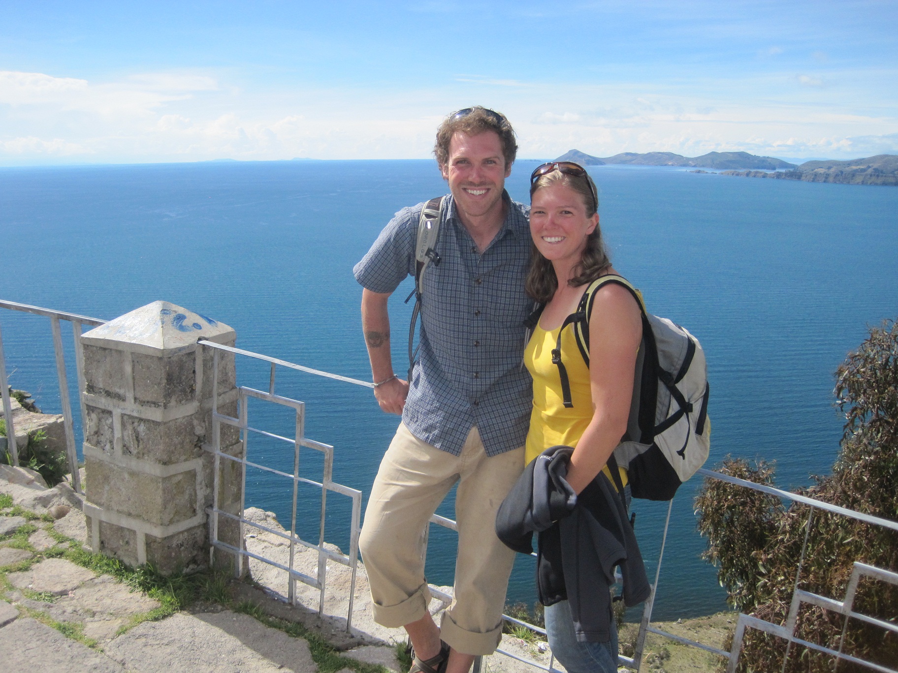
When we finally made our way out of Sorata, and toward Copacabana on the shores of Lake Titicaca, everything about our demeanor relaxed. True, at that point we were ready to get out of the rainy, overgrown jungle, but more importantly we had caught a glimpse of the lake a few days earlier, and we couldn’t imagine anything better than a week spent on its shores. We planned on spending a couple days in the touristy town of Copacabana (even though this place sometimes gets a bad rap, Don and I had both grown up in tourist-driven lakeside towns and we had a hunch we’d feel right at home) and then complete a 3-day trek on the famous Isla del Sol. Nearly half of our 3 hour drive from Sorata to Copacabana skirted the shores of the magnificent Lake Titicaca, and in that time I probably snapped over a hundred photos. Our faces were plastered to the windows, and with every new turn, we exclaimed in awe, “Can you believe it?” “It just keeps going!” “Look how blue it is!” “This place is unbelievable!” We were in our element, and the bright shining sun seemed to be congratulating us on our remarkable find. We knew Lake Titicaca was big, but we had completely underestimated its beauty, and now we allowed ourselves to become overwhelmed with excitement.
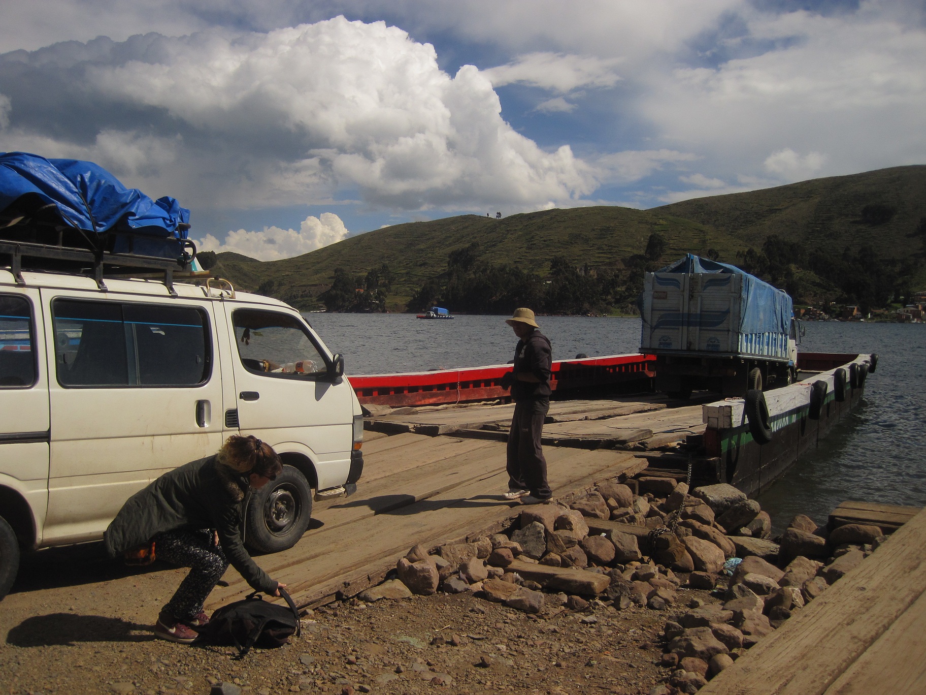
The ferry that takes you across Lake Titicaca and toward Copacabana
Copacabana sits on a large peninsula, and in order to get there from Bolivia, you have to take a ferry across a small straight before driving another 30 to 40 minutes to the town on the northwestern shore. The peninsula itself provides spectacular scenery; rolling hills topple into the water and unlike most of Bolivia, the land is actually mysteriously empty, not a single farm or home dots the surface. We liked Copacabana from the moment we saw it. Everything from the small size to the bright colors to the main street that leads directly to the beach felt just right. We didn’t mind all the tourists or the endless restaurants and shops because again, all these traits reminded us of home. We liked all the energy and activity that pulsed through the air and no matter how many times we walked the length of the shore, we couldn’t get enough of the lakefront view. That afternoon we found ourselves a nice little hostel right on the main street, laid out all of our wet gear in the sun, and later that evening went for dinner at one of the many beachfront stalls. Originally the plan was to begin our trek the following day, but after an afternoon of rest, we decided that it wouldn’t hurt to give ourselves the next day off. Our bodies were begging us for a break, and we didn’t feel at all ready to repack our backpacks.
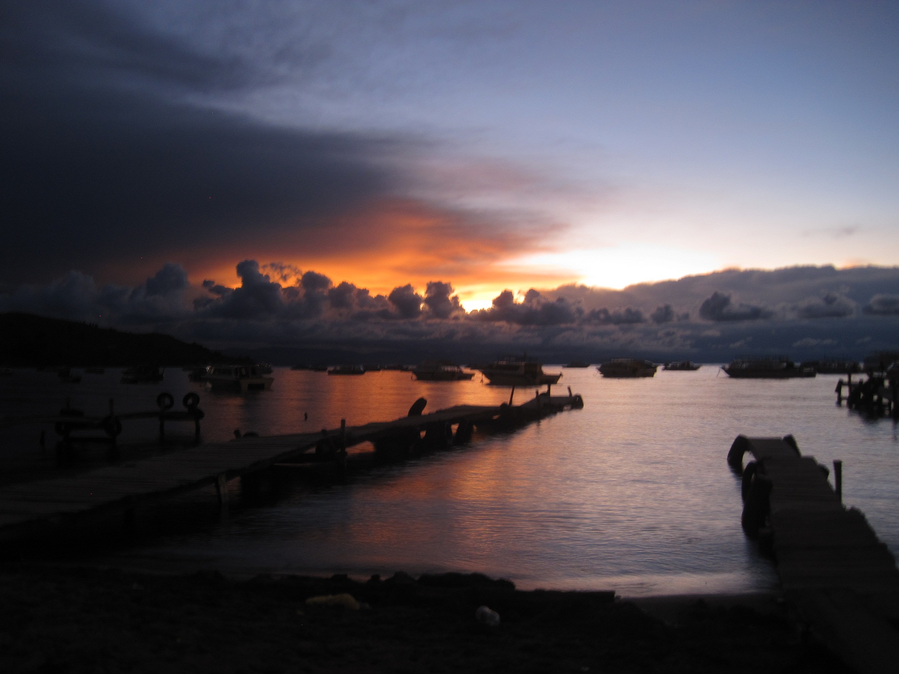
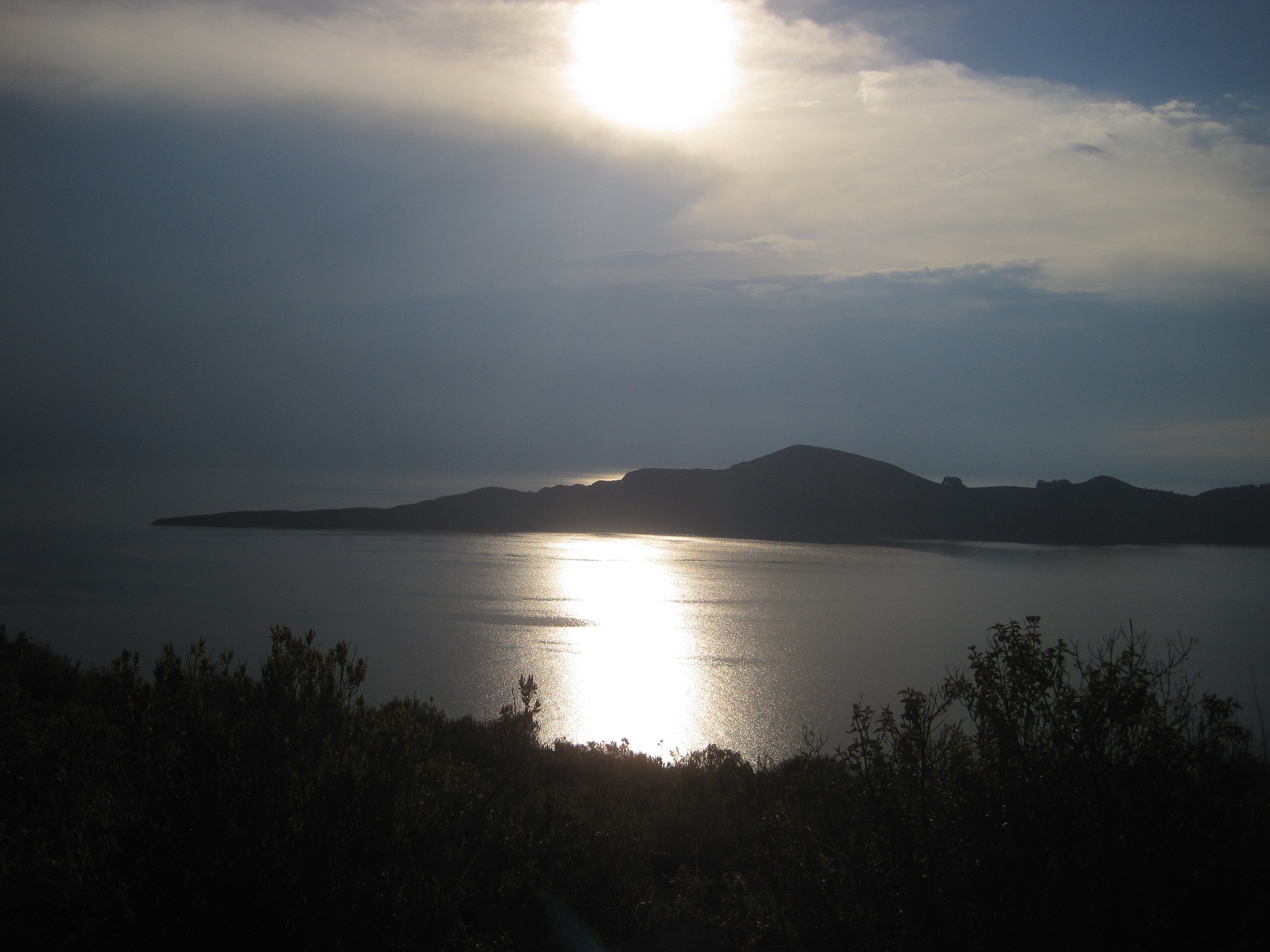
Sunset over Lake Titicaca
We spent our first full day in town exploring, eating, and resting. An easy walk up a steep hill gave us just the view we were hoping for…180 degrees of cobalt blue liquid calm. We couldn’t believe how clean the lake seemed; we could actually see the rocks under the water all along the shore just like 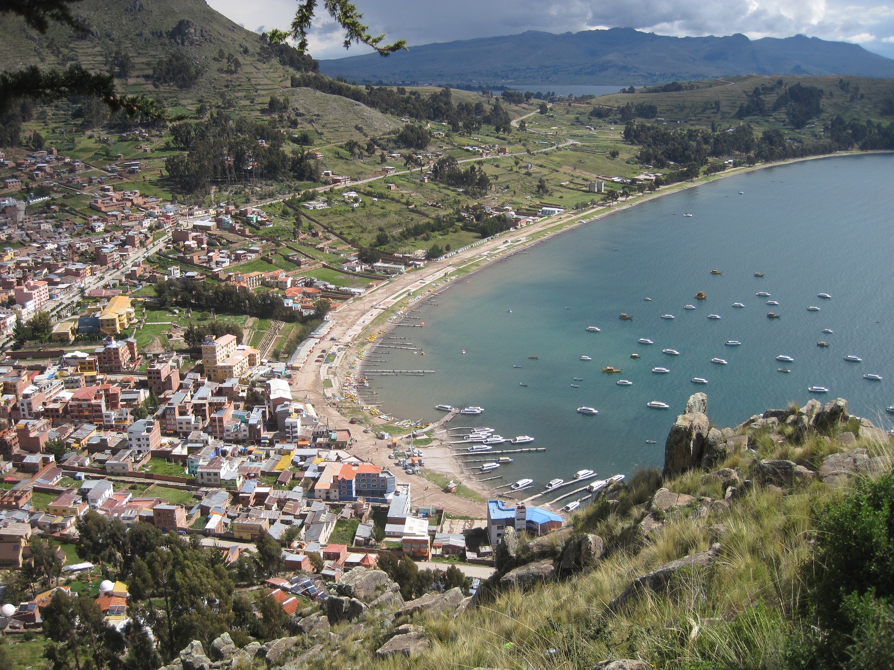 in Tahoe. We couldn’t quite spot Isla del Sol, but we knew which direction it was in, and were able to follow most of the next day’s trail along the shore of the peninsula. After orienting ourselves to our new favorite little town, we chose a coffee shop and settled in for a few hours of Spanish study, punctuated by pleasantly distracting moments of winter Olympic greatness. We readied ourselves for the next day’s trek by going to bed early, and reading through our guidebook’s directions one more time. We knew Isla del Sol should be an easy enough trek because of its overwhelming popularity, but our version included a road-walk from town to the tip of the peninsula that most people skipped by taking a boat straight to the island from Copacabana. We weren’t going to take anything for granted, and we refused to allow ourselves to get lost again after our stressful experience in Sorata.
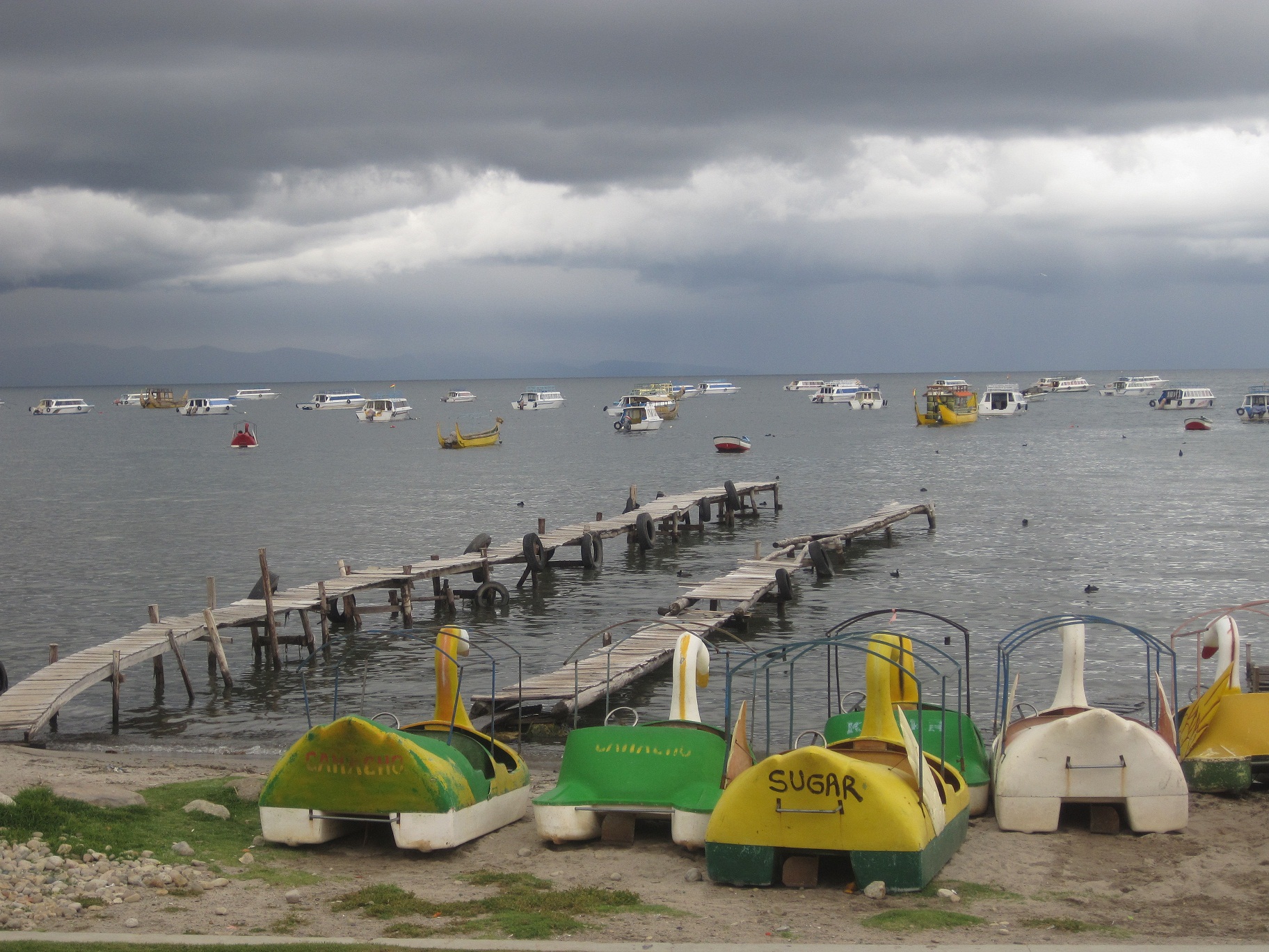
Copacabana beach
The next morning started out with an early rainstorm, which we waited out in “our” coffee shop. It let up by 11 and we gathered up our packs and headed out of town on a wide dirt road that skirted the shore. The following hours found us in a relaxed, comfortable daze. We had the whole road to  ourselves and every couple kilometers revealed a new ecosystem and a myriad of new lakefront views. We walked through a few small fishing villages and one giant eucalyptus forest (the results of a reforestation project) that filled the air with an exotic fragrance. In the afternoon we arrived at the small village of Yampupata on the tip of the peninsula. Isla del Sol loomed in the near distance, and when we got to the town’s tiny beach, we were offered the choice between a motor boat or a much cheaper row boat. We of course opted for the manual row boat (we were in no hurry and much preferred the sounds of an oar entering and exiting the water to a loud, gas guzzling engine) and a weathered old man jumped up and began preparing his colorful vessel for the short trip.
Small fishing village outside of Copacabana
It only took about 30 minutes for us to cross to the island, but I’m sure it would have been longer if I hadn’t offered up my incredible strength and helped row for a bit. In all honesty, rowing was much harder than it looked, 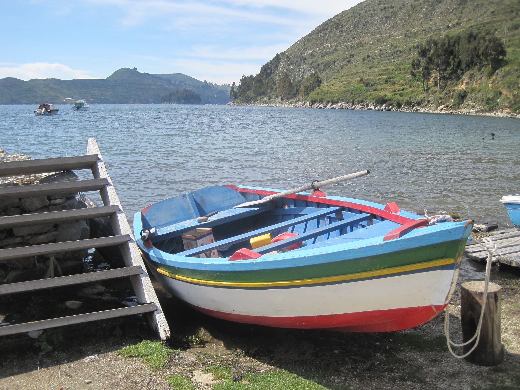 and the old man that took us across was deceptively strong and fit. We hopped out of the boat at the very southern tip of the island and waved goodbye to our new maritime friend. According to our guidebook, a trail should have led directly from the small stone dock around to the western edge of the island, but for all our searching, we couldn’t find such a trail. Every footpath that we followed ended in fields of flowers: beautiful, but not productive. The only trail that made sense led around the eastern edge, which we knew was how we’d end our trip in a couple days, so we decided to just climb up. We labored up and over endless stone terraces
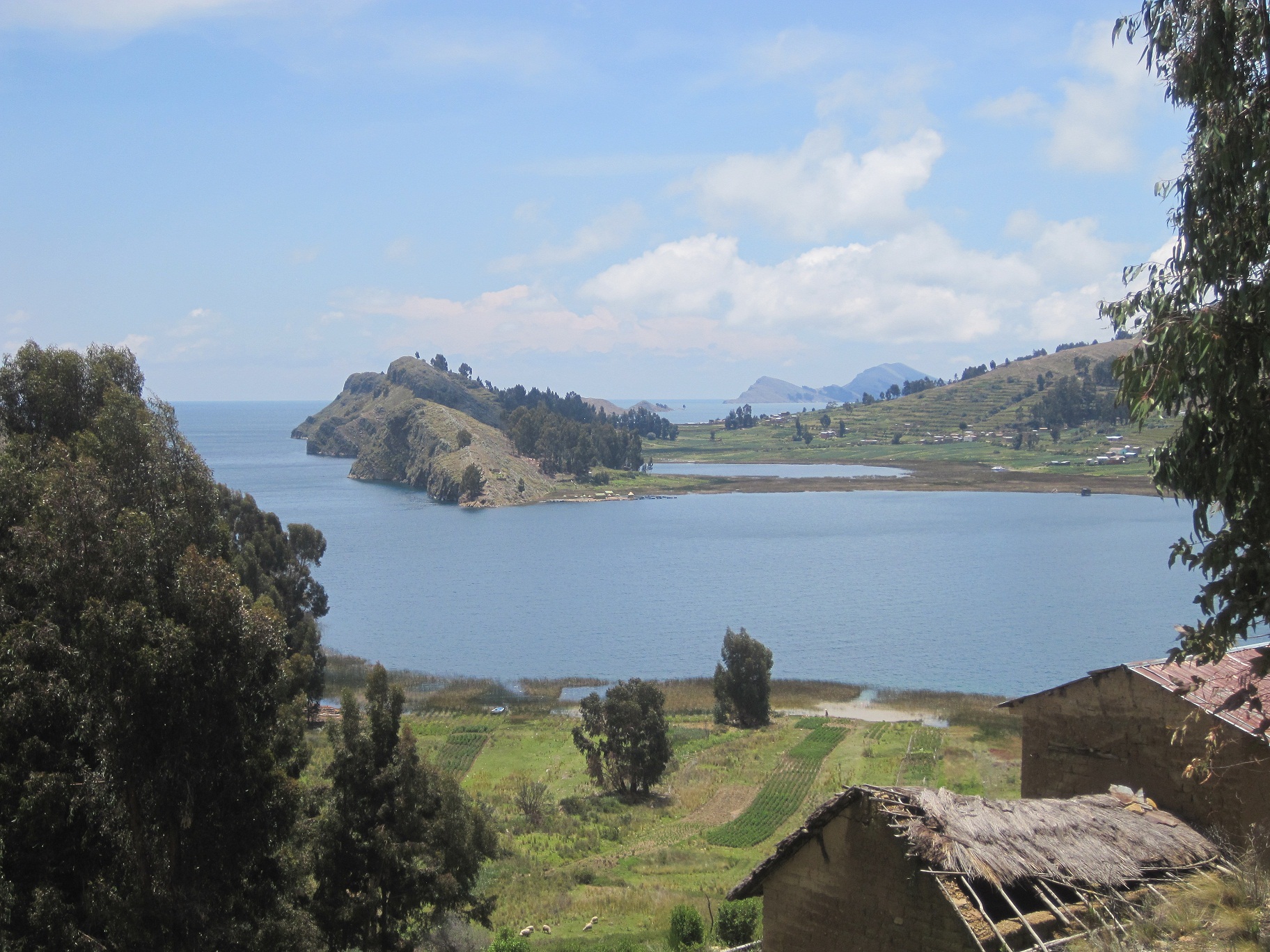
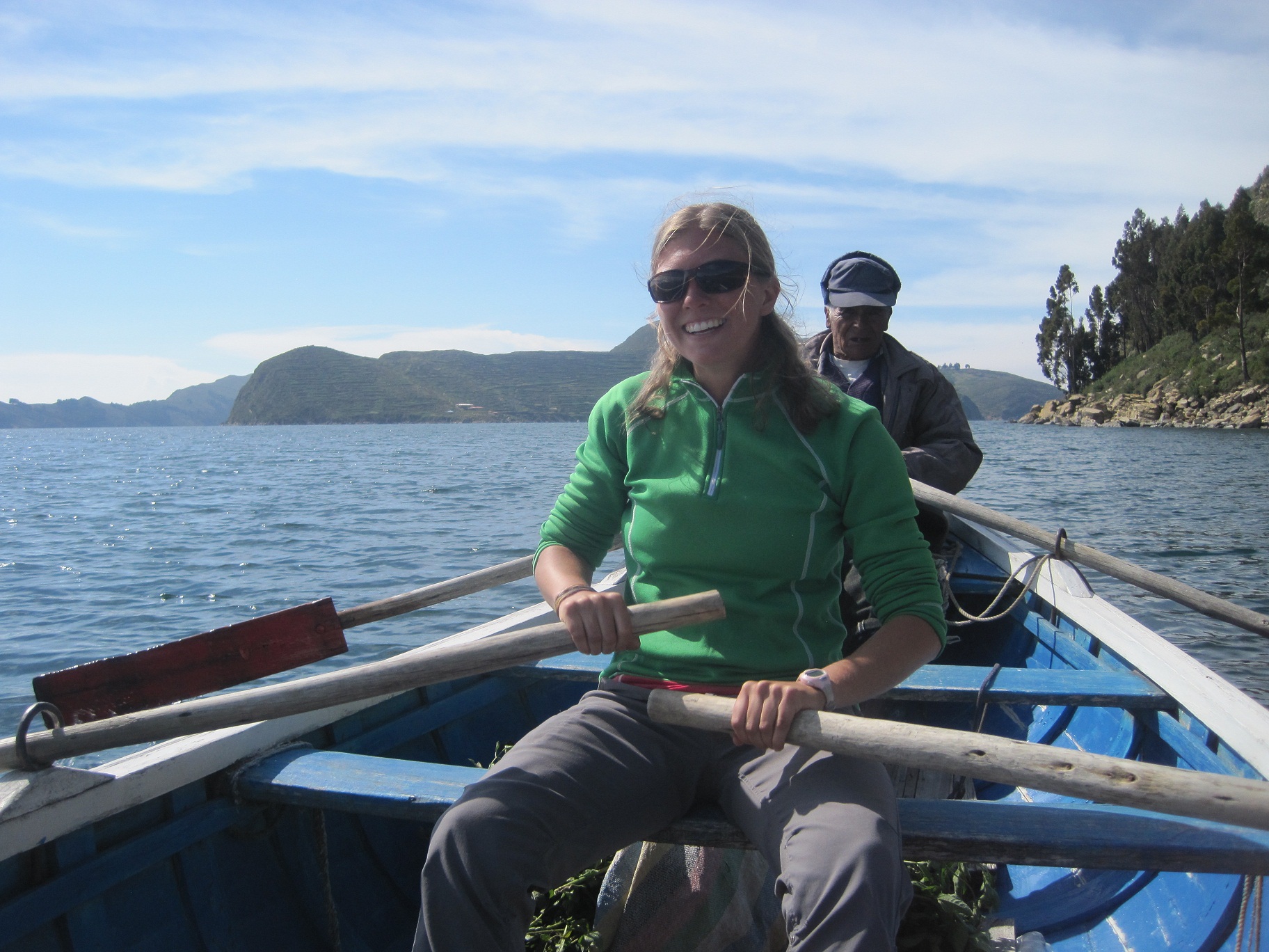 until we were standing on the top of the ridge that ran north to south along the island. Even from this vantage point, there was no visible trail to the west, so we concluded that in the last 10 years the trail system on the island must have grown and changed. We were beginning to think that there was probably a very good reason why Lonely Planet had never republished our rare-find guidebook. After a few frustrating minutes of attempted orientation, we chose to throw caution to the wind, and just hike the island as we best saw fit. From the ridge we could see 360 degree views of Lake Titicaca and we had to admit that even if we weren’t on the “right” trail, there was probably no better place to be. We hiked north along the island’s spine for less than half an hour, passing only one local indigenous couple, when we came upon a flat, open patch of ground. We dropped our packs and looked around, daring one another to reject this ideal camping spot. The view was astonishing, it seemed that we had the entire island to ourselves, and after 17 kilometers of hiking, we were ready to call it a day.
View from our campsite on Isla del Sol
Clouds rolled in as the sun began to set, and we were graced with a sliver of fire-red sky that painted everything from our faces to our tent to the 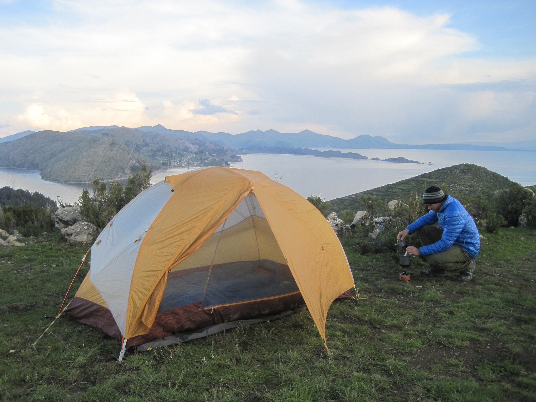 surrounding mountains in hot pink. Fortunately, it waited to rain until we were safely tucked into our sleeping bags, but once the floodgates opened, the heavens held nothing back. For hours we were surrounded on all sides by fierce lighting and thunder, and the rain pounded down so hard we felt convinced that it had in fact turned to hail. When the thunder and lightning clapped and flashed simultaneously, I was convinced that our tent had been struck. I had never been so exposed in the eye of a big storm, and by midnight Don and I had begun to seriously regret our wide-open, mountain-top, middle-of-an-island campsite. There was nothing we could do but wait it out, and like all good storms, it did eventually pass. We woke up in the morning a little worse for the wear, but without any lasting injury or impairment, and decided to sleep in a bit since it was still grey out and based on the area’s very predictable weather pattern, we knew the sun would come out by 11 am.
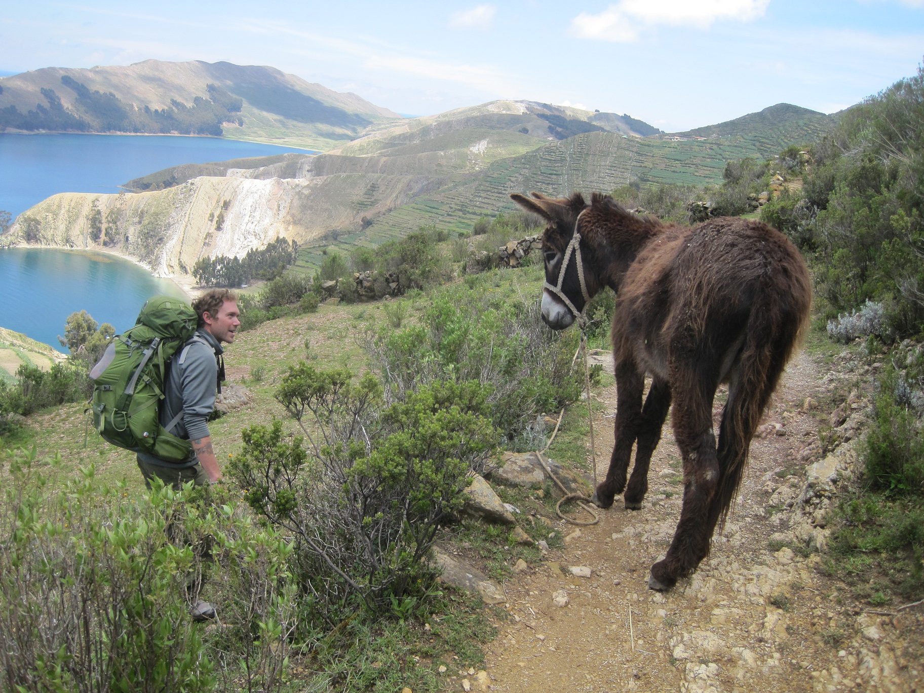
The donkey won the battle for the trail
The blue skies overhead seemed almost surreal after the previous night’s storm. We hiked north on a well-worn path and after a short time arrived in a decently sized town, full of restaurants, internet cafes (!), and hostels. We were a little stunned, for the previous day’s experience had left us feeling like the island’s only visitors, but as the day wore on, we learned how very wrong we were. From the town of Yumani, we missed our turn (which we later learned everyone finds without trouble, because they are coming from the other direction), and ended up scaling down more terraces to a wide 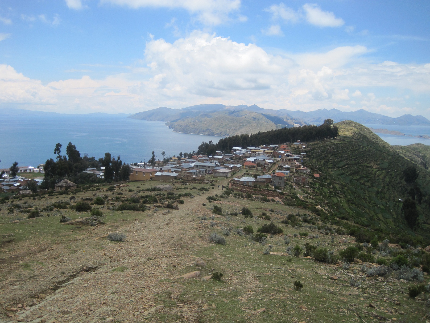 path that had suddenly appeared to our west. It wasn’t until we got to the small pay-station, just outside of the town and placed neatly on the well-maintained road, that we began to understand the current state of the trail system on Isla del Sol. Once we had paid our “Entrance Fee” we began to see multitudes of tourists, all headed in the opposite direction as us, and all absolutely exhausted. They were traveling in packs of 3 to 10 people, carrying small daypacks, and they seemed absolutely defeated by the altitude and hot sun. Every group we passed asked us how much longer they had to go, but we had no idea where they were trying to get. When asked, the answer was always the same, “you know, the southern end”, which only confused us more, but we tried to be helpful and honest. Our answers never pleased them much, and they rarely thanked us for the info before dragging their feet further down the road. It took nearly the entire day for us to learn about the popular tourist route. Most had been dropped off in a small town on the northeastern shore of the island where they had spent the night, then they were spending a full day hiking “around” the island on the stone-paved road to the bigger town of Yumani that we had walked through in the morning, and in the afternoon they would hike down to the water on the eastern edge where they would be picked up by another boat.
By early afternoon we had reached the famous pre-Incan ruins on the northern edge of the island, which included the Sacred Rock, a labyrinth-like building called Chicana, Kasa Pata, and Pilco Kaima. We walked around and took pictures, but I had to admit to myself (and Don) that old stacked rocks just didn’t really do much for me. It was still a beautiful location, but we didn’t linger too long before jumping back on the road and hiking toward a beach that, according to our (outdated) guidebook, was good for camping. We could see white sand from a kilometer out, and became excited about 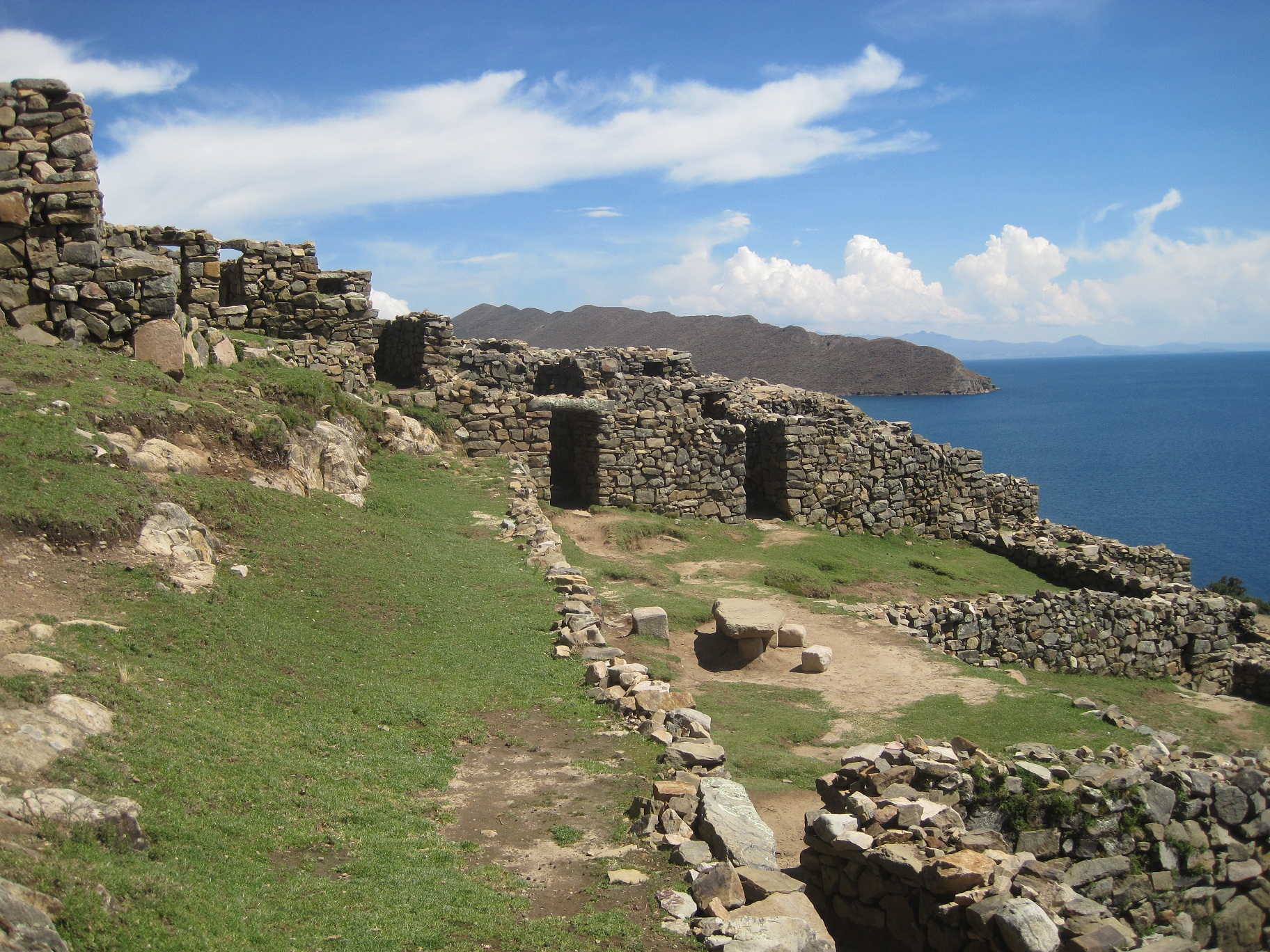 the prospect of finally swimming in the lake and camping on sand, which usually makes for a wonderful night’s rest. The cove also looked far more protected than our previous night’s ridge, so that brought some comfort. Unfortunately, after taking a long, narrow path down to the water, we were greeted with more than just white sand and gently crashing waves. A large, undeniable sign stood directly in our path with the words “Camping Prohibido” written on it and a picture of a tent crossed out just in case we didn’t speak Spanish. We couldn’t believe it! Bolivia may be lacking in safety regulations, and rules in general, but for all the trouble that the laxity can cause, it also allows for a lot of freedom. We could count on one hand the number of times a sign had prohibited anything at all. There was one small home built near the beach and we were almost positive that the owner wrote and placed the sign himself, but we were also convinced that he couldn’t possibly own the entire beach. Probably just tired of tourists setting up camp so he took actions into his own hands. Whether legitimate or not, after discussing pros and cons, we decided we’d rather not get into a brawl with a Bolivian land owner, especially over a sign that we couldn’t deny seeing. We went for a swim (even more refreshing and relaxing than we had imagined), loaded up on water, and hiked back out to the road.
We definitely weren’t expected what we saw next. Back on the trail we were passing other people every couple minutes, and after we rounded the next  curve in the road, we had in our sights the port-town of Challapampa, and a long beach covered in dozens of tents and just as many tourists. They were playing guitars and drums, swimming, collecting water from a stream that emptied into the lake, and setting up or taking down shelters. It was a hippie haven, not normally our cup of tea, but we thought it would do just fine for a night. Surprisingly, we learned that camping on the beach was free, so we joined the ranks, set up our tent, and enjoyed a night of cooking, reading, and people watching. We fell asleep to the sounds of the djembe and laughter, the scent of weed wafting overhead, and smiled to ourselves as we thought about what a difference a few kilometers of hiking can make.
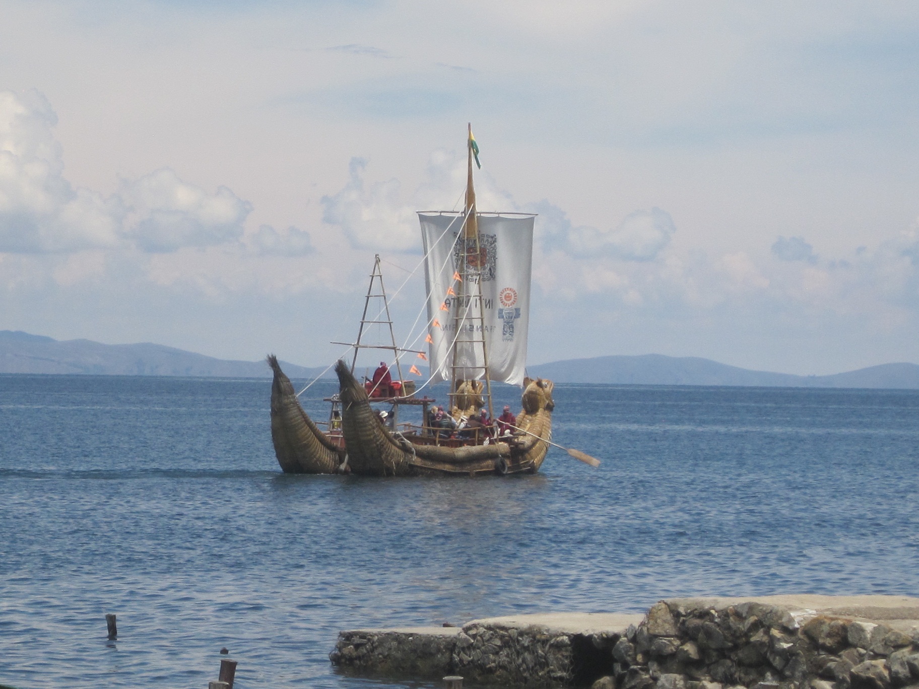
Traditional reed boat on Lake Titicaca
Our final day on Isla del Sol was short and sweet. We hiked away from town in the morning, and within minutes were once again surrounded by only the sounds of babbling brooks and cheerful birds. We were back on a path that few tourists ever saw, connecting the town of Challapampa to the southern 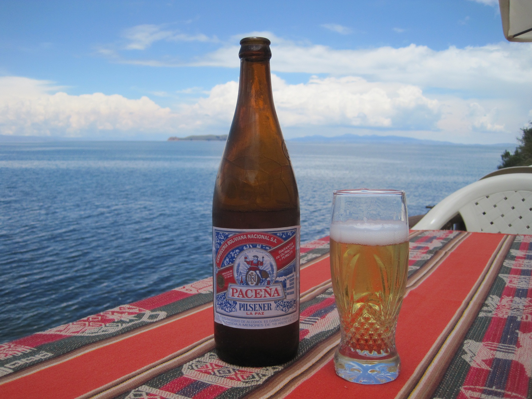 port near Yumani, but along the eastern edge of the island. This time, from Yumani, we headed toward the water, and discovered that the little town was significantly more developed than we had thought. The buildings and homes crowded the streets all the way from the ridge of the island to the lake, and all we could think was how grateful we were to be hiking down the steep path and not up. The port was equally developed, and featured a number of restaurants with decks that overlooked the water. After paying for our passages back to Copacabana, we sipped drinks in the sun and waited for our afternoon boat. We weren’t due back at Emma and Rolando’s eco-campground for another week, so we talked about what we should do next. With fatigue weighing heavy, and the absence of computers and internet irritatingly noticeable, we decided to just take it easy, for once. We’d spend another night or two in Copacabana, and then find somewhere cheap and central in La Paz where we could take our time getting to know the city, catching up with friends online, and getting some decent rest before our month of hard work began in earnest. That afternoon we climbed on a boat packed full of tourists from every corner of the globe, and as we stared out at the lake that would never cease to bring us awe, we found ourselves surprisingly excited to be returning to the city of La Paz.
Rochelle, you really have it down correctly, what a chance of a lifetime, sign me up! You are such a beautiful and intelligent young woman.