Finding our way in Sorata
 The journey from La Paz, Bolivia to the small, jungle town of Sorata should entail a simple 3 hour minibus ride. However, as anyone will tell you, nothing is exactly “simple” in Bolivia. We had used public transportation to get from Emma and Rolando’s home back to the city center where we could eat lunch and use the computers at an internet cafe, but we knew that the buses for Sorata left from the city’s cemetery, and so eventually we began looking for a micro headed in that direction. It was midday on the first day of the school year and the streets were clogged with people, including hundreds of school-aged kids in uniform who had been let out after their first half-day. We began walking uphill (everything is uphill in La Paz) toward the cemetery while flagging down micros, buses, and taxis, but every vehicle was packed full of people and refused to take on two more passengers carrying two backpacks each. It was a warm afternoon, and after about 1/2 mile of walking, we stripped off our jackets, and continued on our way. At some point we both silently accepted that we would end up walking the whole way to the cemetery, a 1 to 2 mile walk uphill with all our luggage at 12,000 feet elevation on ridiculously crowded streets. When we finally reached the “bus stop” for the Sorata buses, we shucked off our luggage with relief, bought a huge bottle of cold water, and climbed on a minibus to catch our breath. Even though our knees were pressed up against the seats in front of us, and our bums were numb within a couple minutes, we were happy to finally be on our way. Sorata would serve as the trailhead for our next backpacking trip, and we were eager to get back into the mountains and out of the big city.
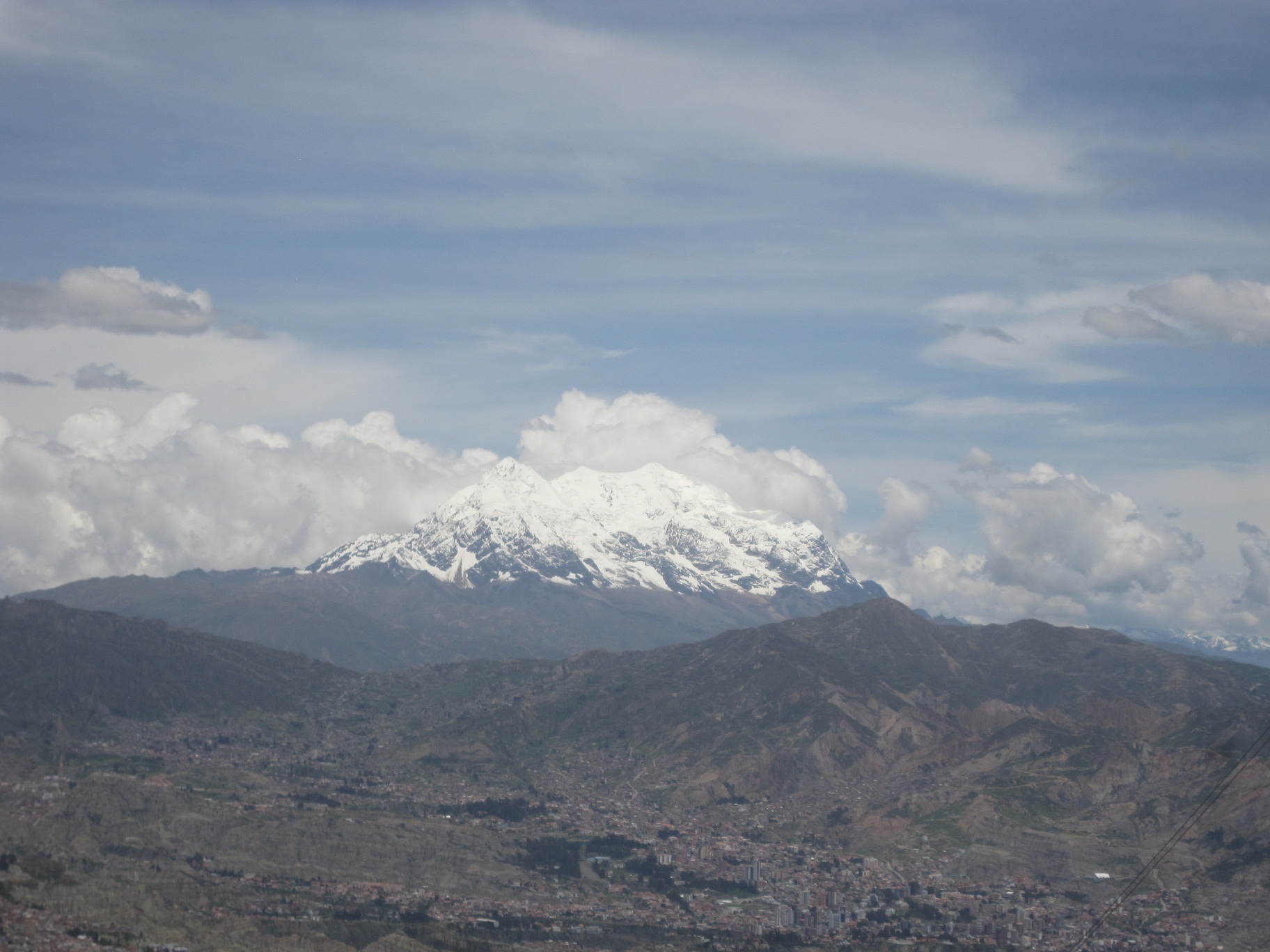
A View of La Paz, Bolivia
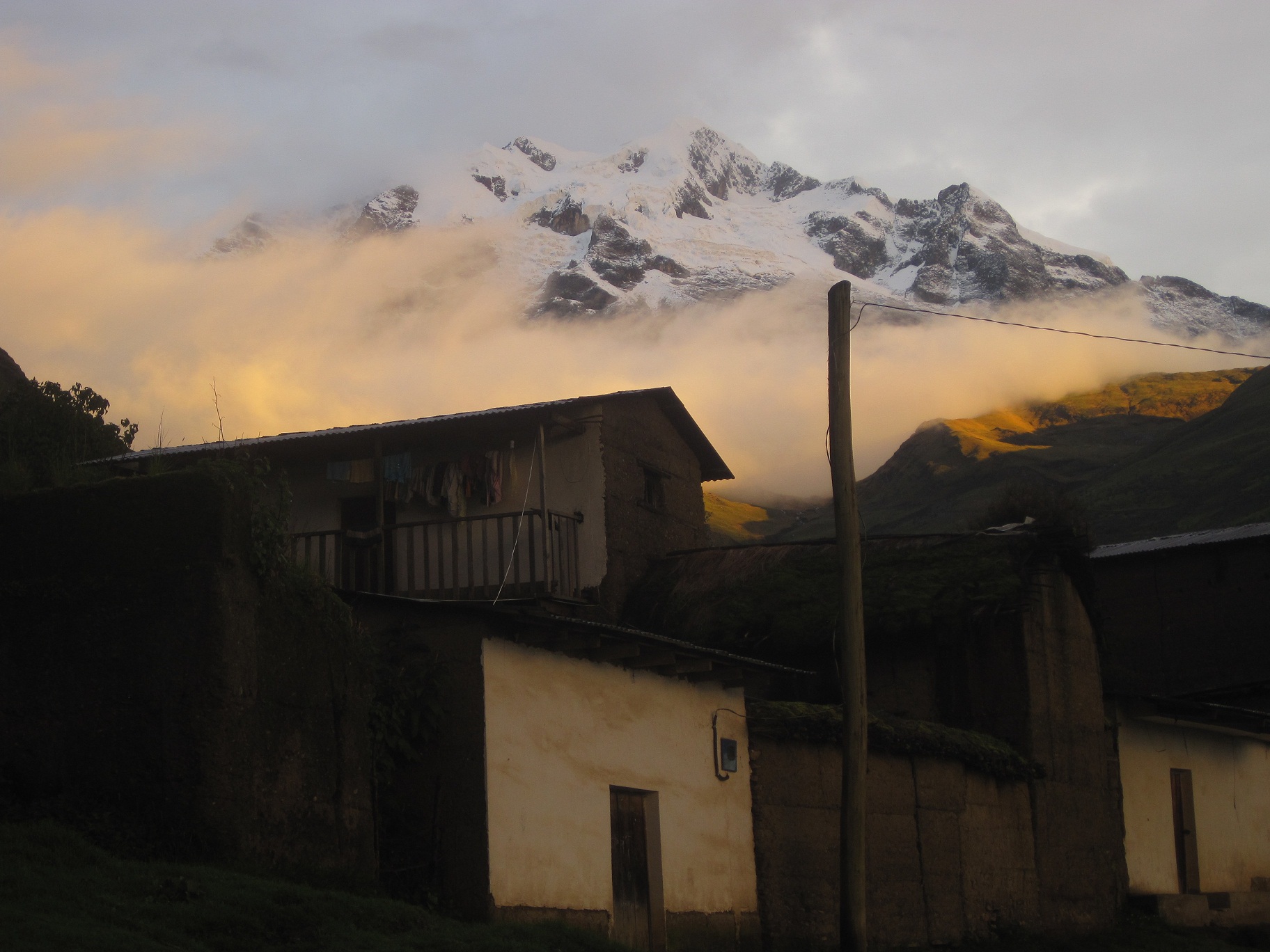
Once out of La Paz, we sidled up alongside the Cordillera Real mountain range and for a solid hour had incredible views of snow-covered peaks to the East. At one point, we managed to pull our eyes away from those beautiful mountains, and were pleasantly surprised to see Lake Titicaca to the West. We would be heading to Copacabana and Isla del Sol the following week, and the lake seemed to draw us toward itself like a moth to the flame. Don and I are lake people, and as soon as we spotted that crystal clear water, our excitement about the comping weeks doubled. But first, the jungle. As we neared Sorata, the road spiraled down a big mountain into a lush landscape of brilliant green. Homes speckled the mountainsides, and eventually we spotted the small town of Sorata, nestled comfortably in a river-fed valley, the imposing Mount Illampu (elevation 20,892 feet) serving as picturesque backdrop. Our bus came to a stop on a random corner of a dirt road, just inside the city limits of Sorata. We hopped out and headed straight for the town plaza, the best way to orient yourself to a new South American town. The plaza was typical in most ways: statue in the middle, gazebo off to one side, a variety of benches scattered throughout, and of course, a number of restaurants, internet cafes, and hostels facing in from the surrounding streets. Two noticeable differences were the many palm trees and of course, the ever-looming peak of Illampu that seemed to rise directly out of the buildings on the East side of the plaza.

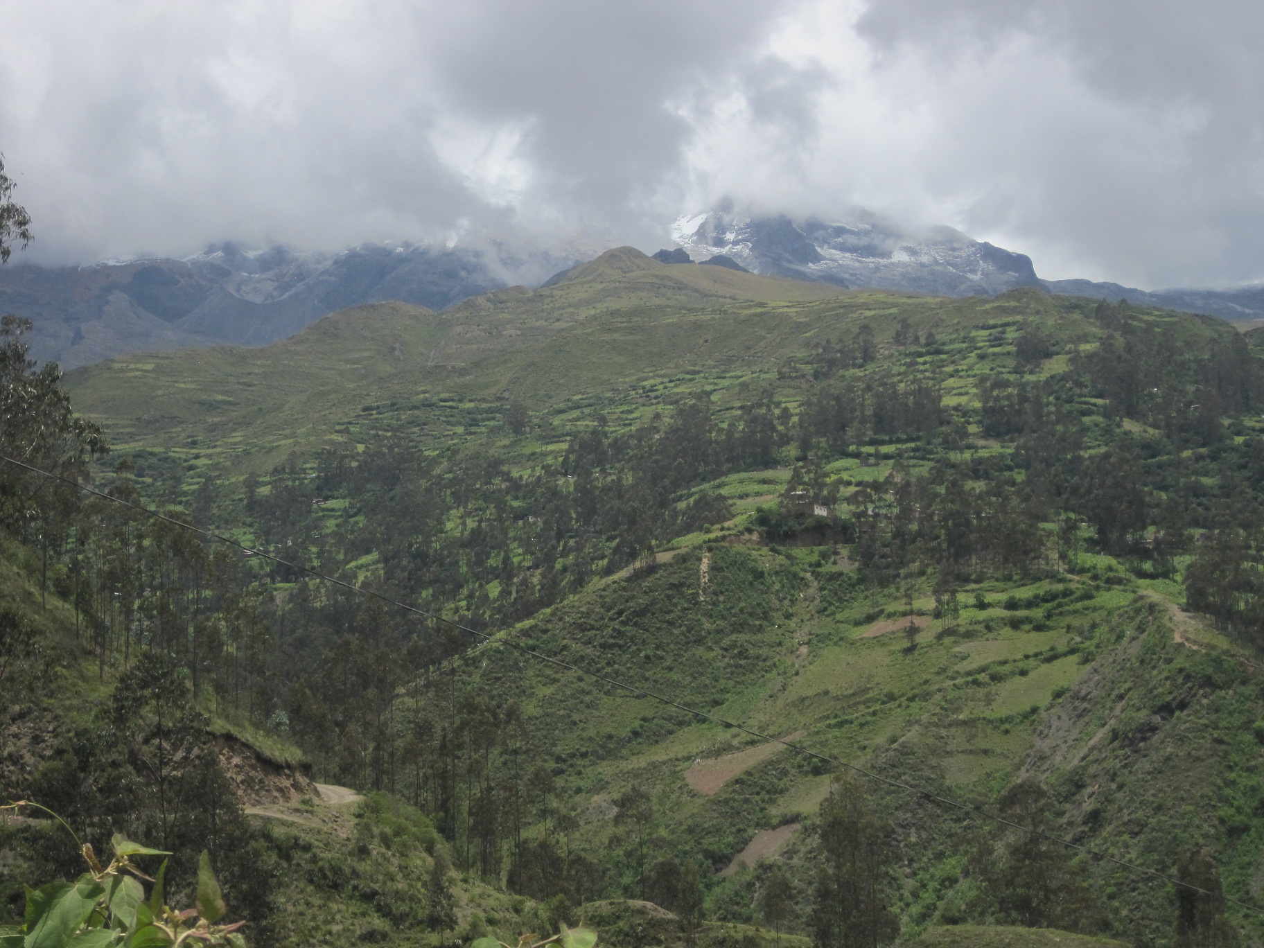
The Cordillera Real
We spent the afternoon running through a habitual series of events – visit different hostels to find the best deal, take note of the different restaurants we might like to eat in, locate the town’s supermarket, or in this case, open- air “mercado”, ask around for prices at the internet cafe’s, and of course, find the ATM. Before we got too far down our list, we walked by the office of local trekking guides and stopped in hoping to glean some more information on the area’s surrounding treks. Before leaving for South America, Don and I had managed to get hold of a guidebook for trekking in the Central Andes that Lonely Planet had only published one year, back in 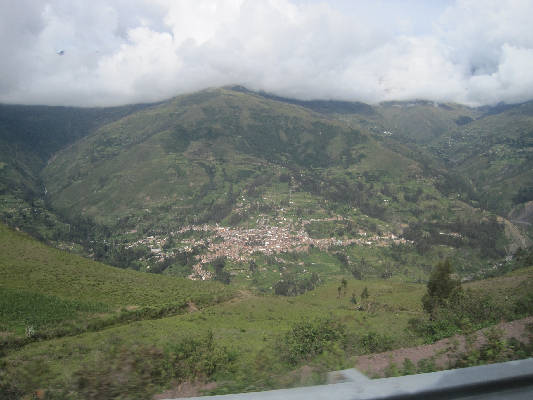 2003, and was therefore a bit of a collector’s item. The book described two different treks that started out in Sorata, one that was 7 days, and another shorter 3 day option. If we could get enough information, we hoped to go big, but we had already agreed that if there were too many extenuating circumstances surrounding the longer trek, then we would settle for the short trip to some beautiful glacial lakes. Not surprisingly, our friend at the guide service office practically begged us to use a guide, claiming that either of the treks would be far too dangerous and difficult for us to attempt alone. We already knew it was the middle of the rainy season, but we were promised that on the long trek we would most certainly be stuck in blizzard-like conditions and would be forced to hike through deep mud for miles on end. Also, there had been many reports of muggings on the trail, and when we told the guide that we had pepper spray with us and weren’t too afraid of thievery, he asked us straight-faced whether we were prepared to hold off an entire indigenous, Aymara-speaking village with our one vial of pepper spray. Eventually it was agreed that the longer trek was out of the question, especially if we refused to pay for a guide. So then we were left with the 3 day option to the lakes. The man we were speaking to still insisted that we use a guide for this trek, mostly due to the unclear, unmarked trail, but once we got talking prices, Don and I knew this wasn’t a viable option for our situation. We had the guide book, and planned on buying the detailed topo map of the area, so we couldn’t imagine that the hike would be a problem. What this man didn’t understand, we thought silently to ourselves, was that we had more experience than most. We left the office grateful for all the information, but still confident that we could manage the shorter trek on our own.
 That afternoon, as we worked our way through our “orienting” activities in Sorata, we hit one giant roadblock. It came time to look at our money situation, and pull out some more for this part of our journey, but to our great dismay, after a quick search and then a bit of probing, we learned that the town of Sorata did not in fact have an ATM. In a sort of panic, we counted our money and found that we had less than 400 Bolivianos left, the equivalent of about $50. Our bus ride to Copacabana was going to cost nearly 100 bolivianos, which left us without much of a buffer. Backpacking food didn’t usually cost much, but this time around we would need to be especially frugal. We reluctantly conceded that we would have to leave town right after backpacking, and not stick around for a full week like we had planned. We would need to start our trek the next morning, and hope that we could stretch our money so we didn’t have any problems. Now a guide was definitely out of the question, so we put that option out of our minds, and instead focused on our maps and on the step by step directions that were written in our guidebook.
 The next morning, loaded up with lots of calorie-rich, cheap-as-dirt food, we left our hostel and started down the main road in town, looking for the trailhead mentioned in our book. It didn’t take long for us to get off-track. When we realized that we had been on the road too long, and that we had clearly missed our trail, we chose one of the dirt roads that headed up toward Illampu, and began climbing past small homes and farmed plots of
 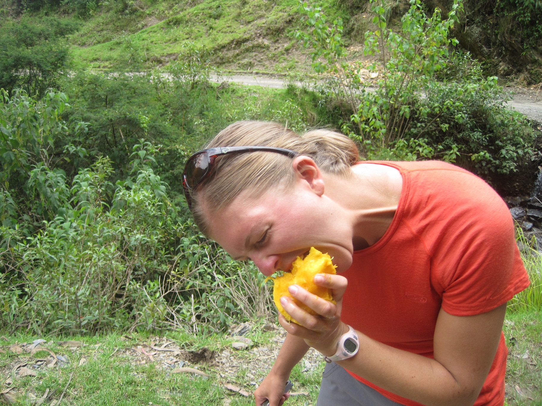 land. We had our topo map and knew the general direction we needed to go, so besides having to climb more directly uphill than we would have liked, we didn’t have much trouble finding the dirt road that we were meant to be on. The day was perfect for hiking, and once we were on the “road” we walked along blissfully, proud of ourselves for refusing a guide, and eager to get to our first lake where we’d spend the night. About midday we stopped for a tasty lunch, where Don enjoyed his first perfectly-ripe full mango and declared it the best fruit on the planet. We continued on unimpeded, a quickly rushing river cascading through a deep valley to our right, and the occasional goat or sheep herder passing us on the road. In the afternoon we reached our first big landmark, the tiny rural village of Quilambaya, and congratulated ourselves on a job well done. However, our pride quickly turned to confusion as we attempted to follow our guidebook’s directions, and couldn’t for the life of us find which trail we needed to follow out of town. Eventually, after many slow, thorough readings, we thought we had found the right trail, and followed it confidently out of town and along the side of a mountain.
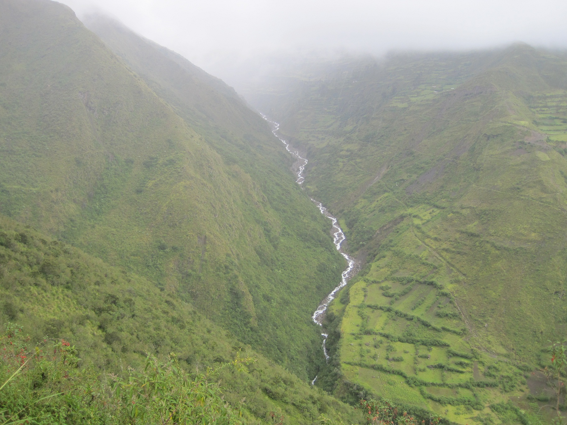 Half an hour later, before we knew what had happened, the blue skies that we had enjoyed all morning clouded over and a heavy rain began to drench the valley. We marched on, clad in our high-tech rain gear, still confident that we’d soon arrive at the bridge mentioned in our directions. Unfortunately, after over an hour of hiking beyond Quilambaya, it became devastatingly clear that we were not on the correct trail. We had ended up at the confluence of two large rivers, where our trail ended abruptly at a steep cliff overlooking a steep canyon. There was no way down, and we couldn’t see any bridge, so we turned our drenched selves around (our rain
 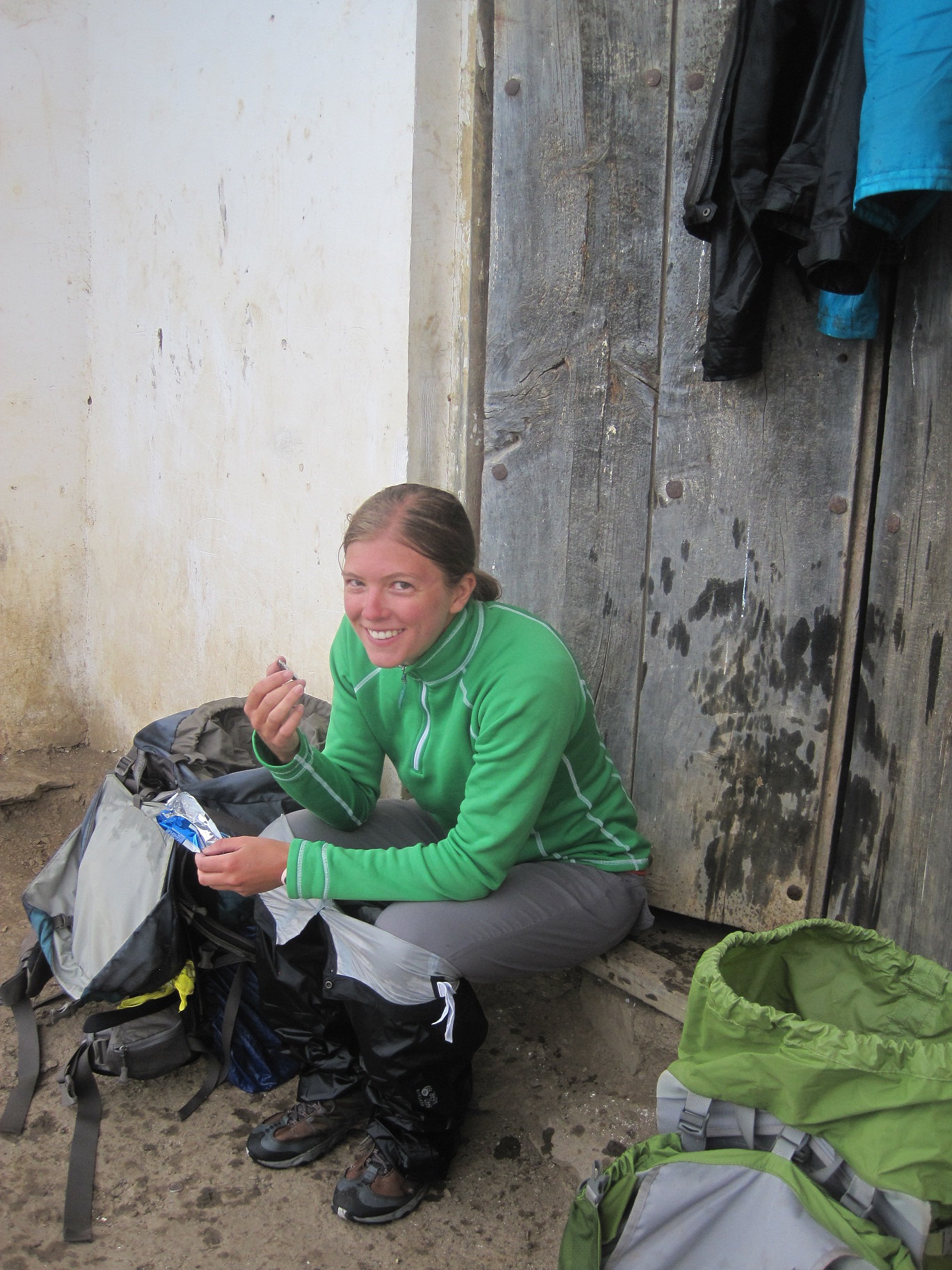 gear hadn’t stood a chance against the thick, wet brush that we had pushed our way through) and headed back toward the little village in the distance. We still had a little hope left, and planned to ask some locals in town which trail to take, so we were happy to see a teenage boy waiting out the storm under a small shelter when we got back to Quilambaya. We asked the boy how to get to the bridge leading to the next town mentioned in our directions, but after pointing out the very obvious road that led out of town, he regretfully informed us that the bridge was uncrossable in the storm, since it quickly floods when the valley fills with rain. Our faces fell in defeat, but we decided that we would at least hike down to the bridge and then camp there and cross when we could. We began our descent out of town, but sooner than we would have liked, the defined road we were following turned to a small footpath, and another 20 minutes later, completely disappeared into a scattering of farms. We had descended steeply, and the rain was still coming down in sheets, but we had no choice but to turn back and return once more to the village. The trudge uphill was disheartening, and as we discussed our options for the night, we realized that there wasn’t going to be any relief in sight. We hauled our packs up onto the steps of the village’s padlocked church, peeled off our soaking jackets and pants, and as the cold slowly seeped in, munched on some food and contemplated the best location for our tent.
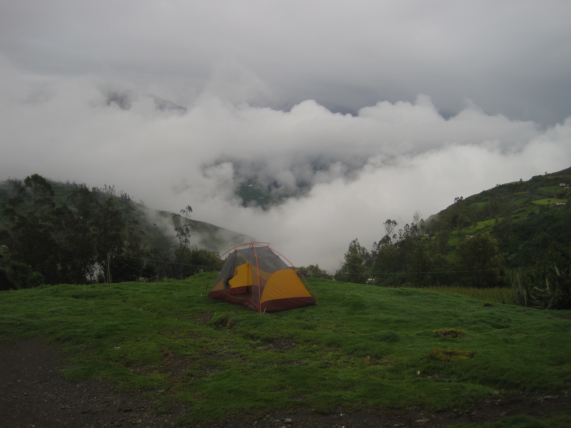
 By the time we had set up our tent in the rain, and Don had cooked us dinner under the church’s roof, we decided that we had had enough and the next morning we would turn back. Just before turning in for the night, during a break in the storm, I left the tent and headed for the nearest river crossing just South of town where I planned on getting us water and washing our dishes. I ran into a couple local girls on the road and when they saw my intentions, they told me the river was far too dirty to get any drinking water, and offered instead for me to come with them to their house where they had an outdoor tap. When I explained our situation to them, they invited me into their home, where they said I should talk to their dad about potentially hiring him as a guide. Not wanting to be rude, I followed them into the tiny cement hut where an older couple stoked a wood-burning stove and sat cuddled up under a pile of blankets. I spoke with them for a few minutes, all the while marveling at their living conditions and trying to take in every detail so that I’d always remember to be grateful for the privileged life I live. We eventually concluded that I simply didn’t have enough money to offer the father in exchange for his guiding services, but I thanked them nonetheless for their hospitality and headed back out into the storm, and toward the warm glow that emanated from our tent on the hill.
 The next morning, under grey skies, Don and I packed up our gear and headed back down the mountain toward Sorata. Our trip felt a lot like a failure, but we tried to focus on the pleasant two days of hiking that we did get in, and remembered to appreciate that we had made it as far as we did. When we got back to town, we picked up our day packs from our hostel, and began another journey, this time toward an eco-campground outside of town where we hoped to spend the night. Unfortunately, this was not our week, and what should have been a 20 or 30 minute walk became an exhausting couple hours of fully-loaded hiking. We walked in the direction of the campground, and at one point turned off the paved road onto a small trail where a sign for the campground pointed downhill. We climbed down a steep, overgrown trail toward the river, but were stopped short by a man who was downing trees and had completely blocked the trail. Forced to veer left, we continued down, eventually ending in the middle of the jungle at the river’s edge, no bridge in sight. We scrabbled upstream until we finally found the bridge that led to the campground on the other side of the river, but, as a part of the big conspiracy against our week’s efforts, the bridge was closed and covered in signs saying “Danger”, “Keep Out”, and “Do Not Cross”. We had no choice, there was no other way out of the canyon, so one at a time we tip-toed our way across the defunct bridge over raging rapids, willing ourselves and all our luggage to weigh less. When we finally made it across, we found ourselves on a beautiful, but empty property. We walked up to the main entrance, only to find it locked and our way out of the obviously closed campground blocked. With no other viable options left, we climbed over the large gate to get out, and began the long road walk back to town. Of course, unsurprisingly, it began to rain within minutes, and by the time we got back to town we were once again wet, cold, and tired. Under the cover of the plaza’s gazebo, we admitted defeat, and decided to head to the town’s “bus station” and hopefully find a ride out of town. We finally happened upon some luck when we walked up and were approached by a group of Argentinians who were chartering a bus to Copacabana and needed two more people in order to convince the driver to make the trip. We hopped on another uncomfortable micro, once again grateful for any ride at all, and as we rested our eyes, hoped with all our might that the Isla del Sol was so named because of year-around sunshine and warmth.
Wow! Your courage and physical strength astounds me. Sorry your Sorata and Trekking experience was not what you hoped for albeit how wonderful the beauty you did glean from it. My thoughts are with you and as always, thank you for sharing your experiences with all of us, they are so amazing!! Good luck with your next journey.
Once again you have taken me there Rochelle! I’m going to go take a nap!
Julie just stated to me:
“This is like looking at a dream Kelli. What a blessing to read and to see these pictures. Nice living vicariously through Rochelle. Her flowery, descriptive writing really makes one feel a part of her tremendous adventure!!!” “Stupendous!”
Rosh, I knew the day you were born … you were going to conquer any and everything you set your mind too. I so admire, respect and above all, LOVE you!
Can’t wait to spend a day with you and ask you a million questions! XOXOX, Kelli~